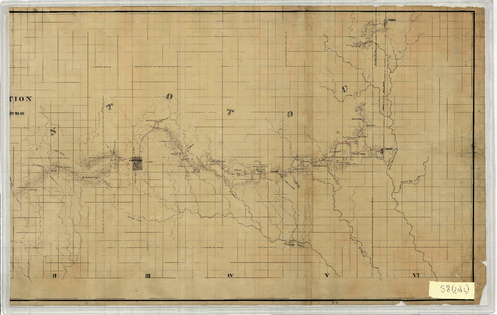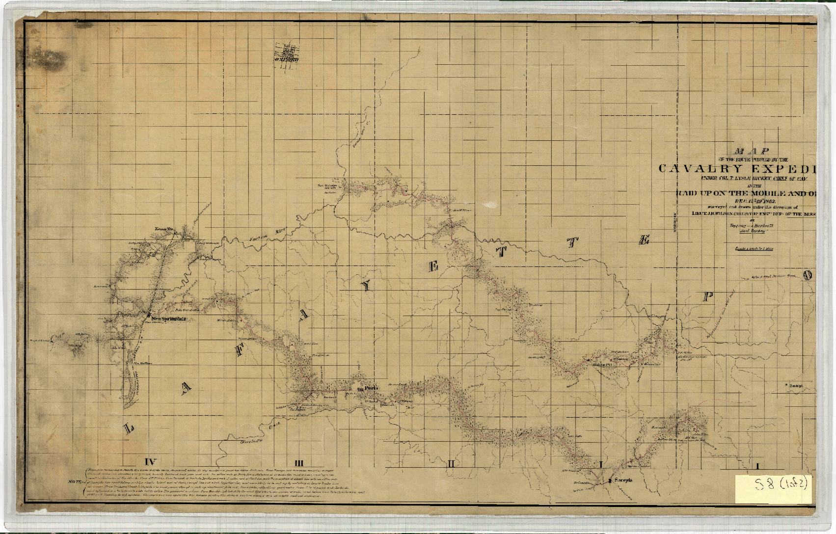
1862 Cavalry Raid
THE CAVALRY EXPEDITION ROUTE UNDER COL. T. LYLE DICKE
CHIEF OF CAVALRY IN THE RAID UPON THE MOBILE AND OHIO RAILROAD, DECEMBER 13-19 1862
This map shows the area of southern Lafayette County, Yalobusha and Pontotoc Counties, and includes Water Valley, Springdale, Yockna Station (now Taylor), Pontotoc, Tupelo and portions of the “Yoknapatapha” River. Additionally, this map also displays many landholdings in the county, including the names of landowners listed alongside their properties and identifying houses, fields, mills, cotton presses and slave cabins.