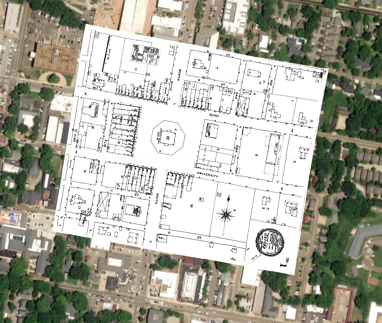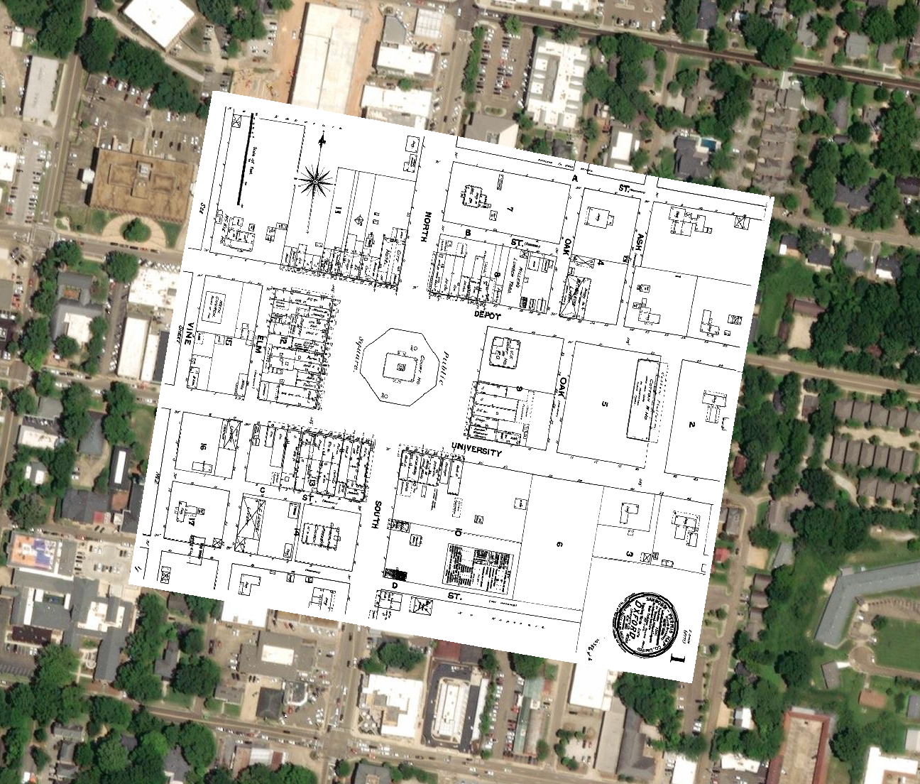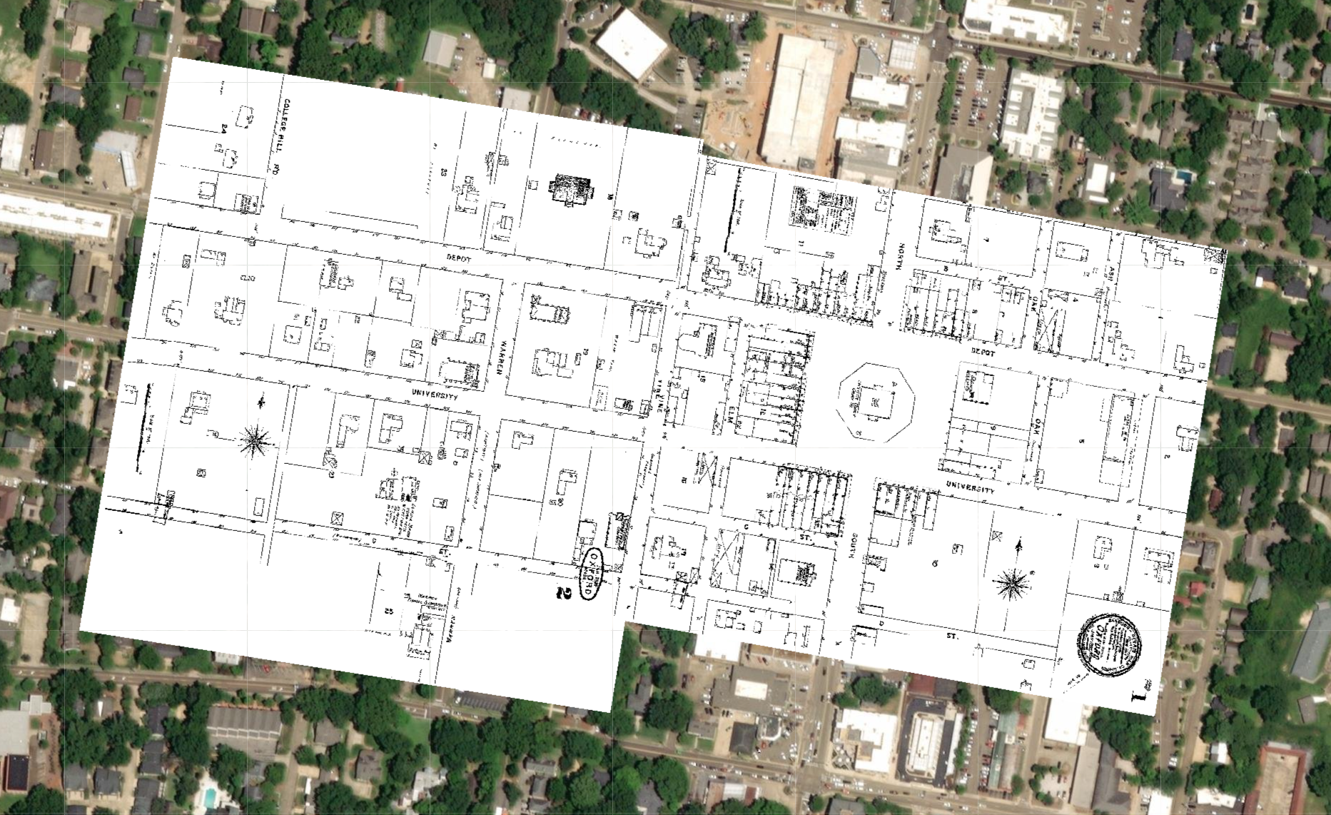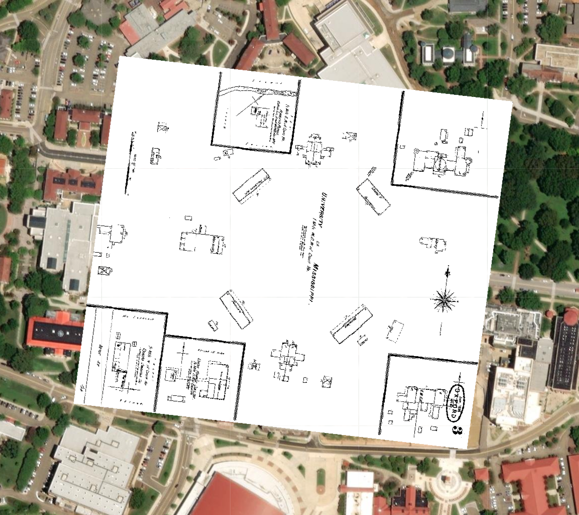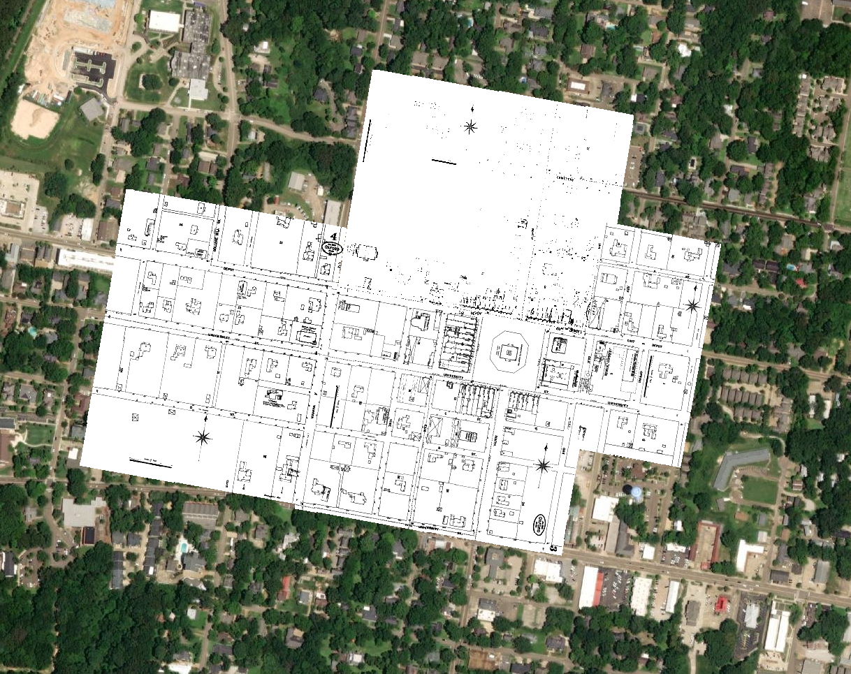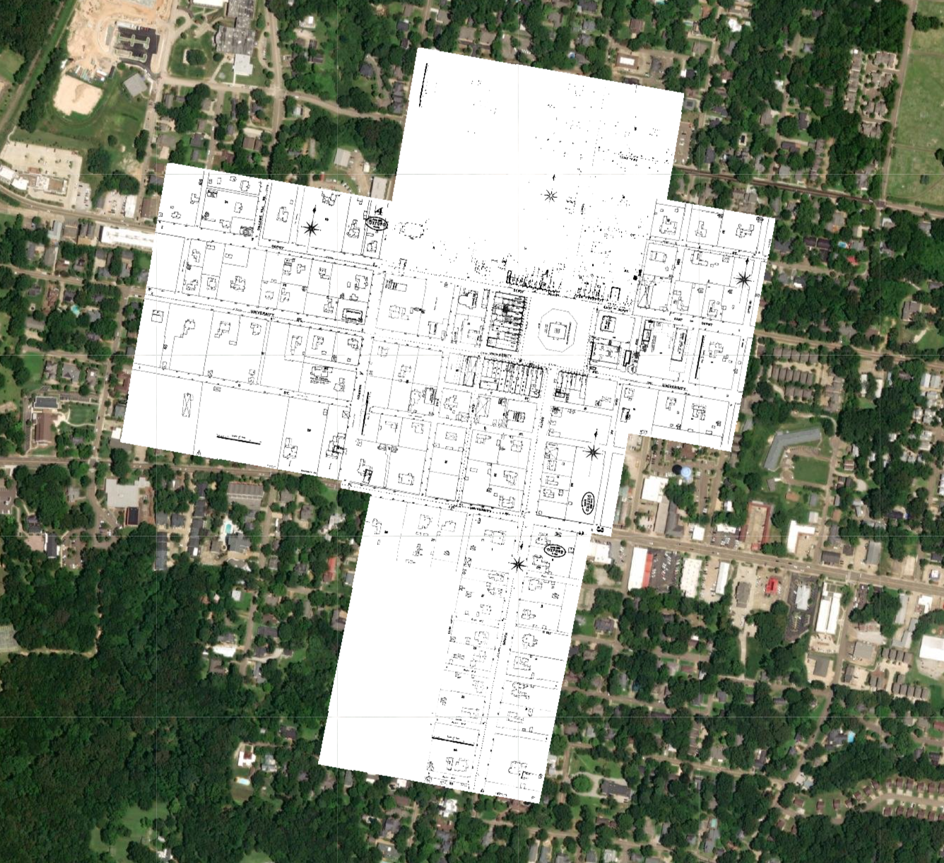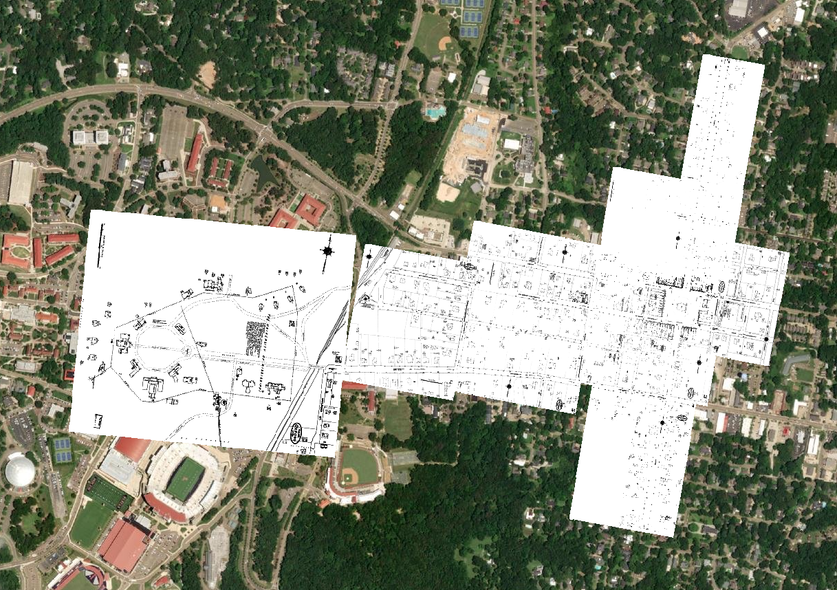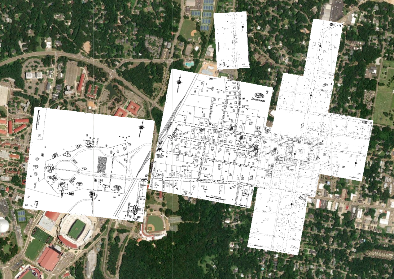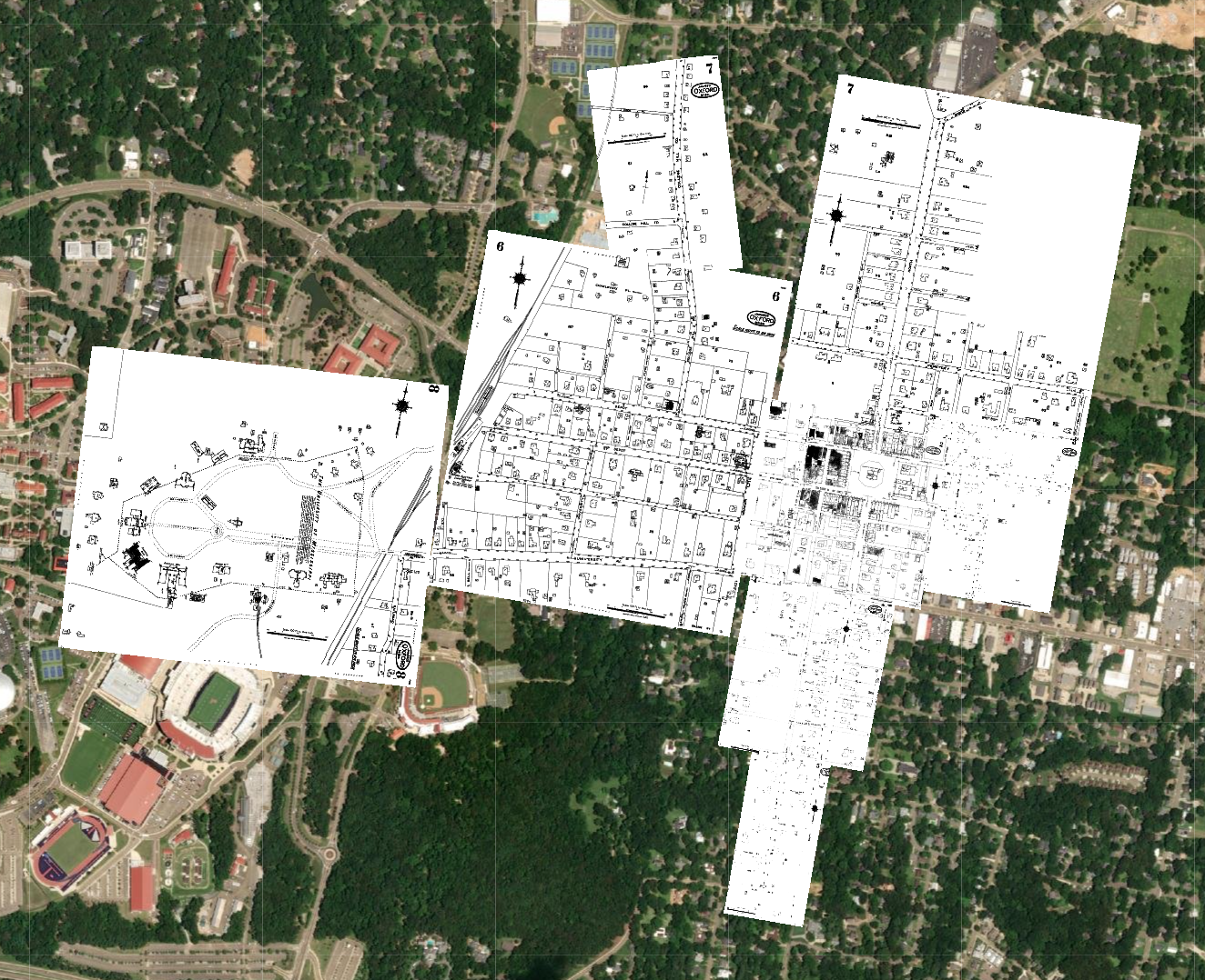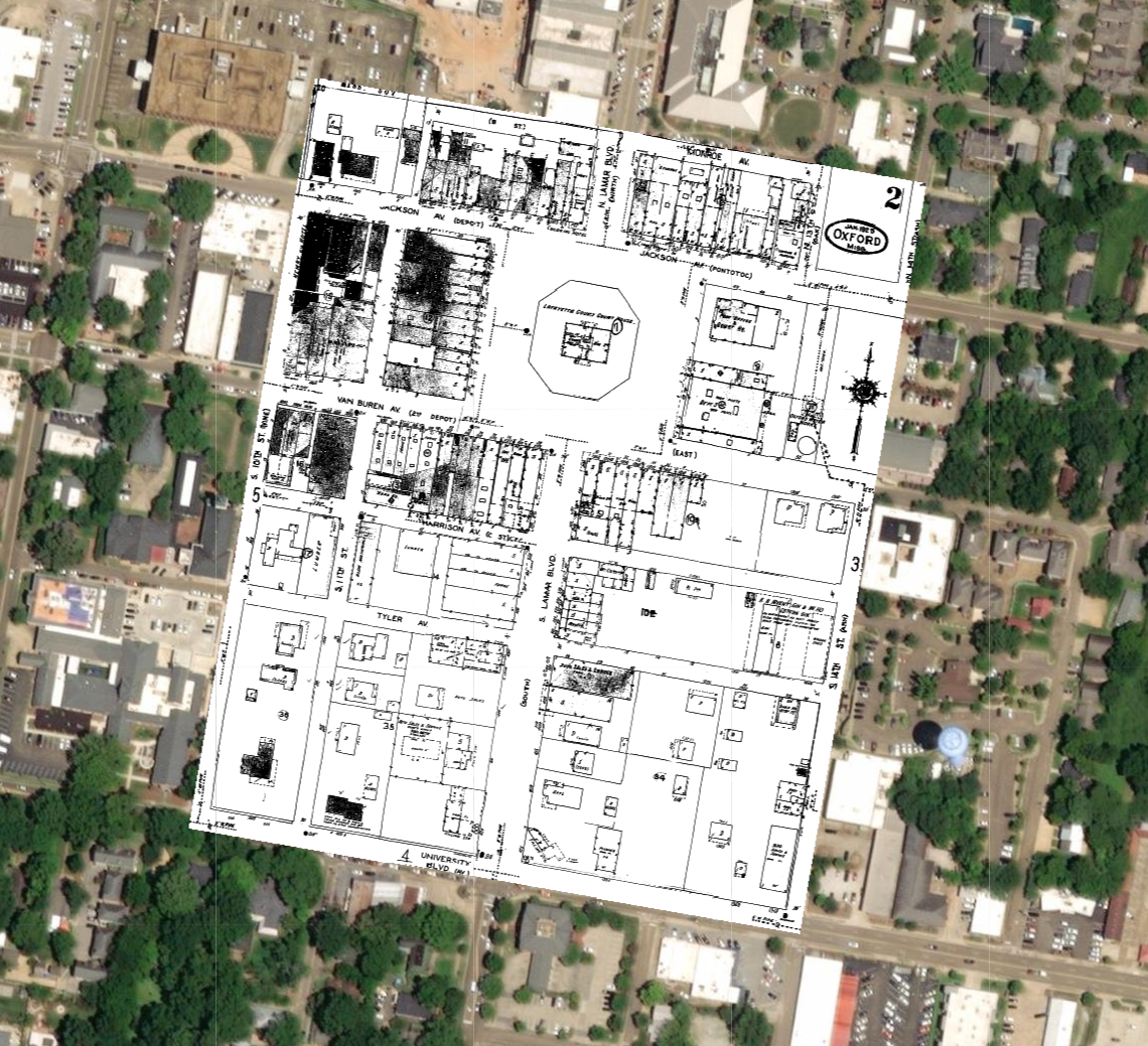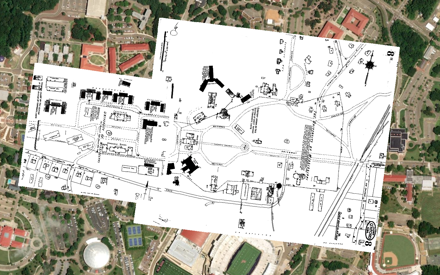
1885-1948 Sanborn Fire Insurance
These maps were created by the Sanborn Map Company to allow fire insurance companies to assess their total liability in the United States. These maps include outlines of each building; the location of windows and doors; street names; street and sidewalk widths; property boundaries; fire walls; natural features such as rivers and canals; railroad corridors; building use; house and block number; composition of building materials; strength of the local fire department; indications of sprinkler systems; locations of fire hydrants; location of water and gas mains; and names of most public buildings, churches and businesses. Sanborn maps are valuable for documenting changes in the built environment over the years.